
Stagger - Northenden Meander
Northenden
Friday 25 September 2026
NOTE DATE - A week later than usual
Tonight's meander is around what is an ancient settlement which has now been subsumed into the bounds of Manchester. The City Council used the Local Government Act 1929 to extend its boundaries to encompass Northenden in 1931. This was as part of their plan to build the garden city of Wythenshaw(!) to house people from the inner city inter war slum clearances.
There are two theories of where the name Northenden comes from. A settlement called Norwordine was mentioned in the Domesday Book of 1086; its name deriving from Anglo-Saxon "norþ" meaning "north" and "worþign" meaning enclosure giving "north-enclosure". Another theory is that the name means "northern dale or valley" from the Anglo-Saxon "norþ" and "þenden", presumably because it was near the River Mersey. This begs the question whether there was a corresponding Southenden somewhere in the Style Ringway area - any suggestions.

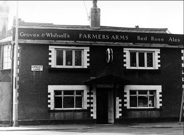 We start our meander this evening at 26 Longley Road, where we will find the Farmers Arms. A longstanding hostelry where the front three low-ceilinged rooms still have the feel of a traditional pub, while towards the rear a large room is mainly for dining which is popular with families. Being owned by John Barras, it offers beers from national suppliers. Cask ale sales have gone up and down, being dropped altogether in 2015, but re-instated in 2016 and currently supplied by Marston's.
 Now a slight departure from a normal stagger, we are going to call in the Wythenshawe Cricket & Sports Club, a previous winner of our Club of the Year. As we are visiting in the summer, expect to see (or evidence of) cricket being played, while in the winter months rugby and football are the games. And as to who takes precedence when the seasons overlap I have no idea!
 It is but a short walk back towards Palatine Road and our 8:30pm meeting place. At 424 Palatine Road we find Lounge About, a bar of two halves, well two shops really. The left-hand half is set out with tables for drinking or dining, whilst through the wall to the right the ambiance changes markedly. Three huge tables, constructed from wooden sleepers, with accompanying benches create a more rustic feel. Décor is very much café-like with lots of mono photos and some individual paintings. Meanwhile at the rear is a beautiful little, secluded beer garden where, if the weather permits, you can get away from the bustle of Palatine Road. Whoever tends this garden does so with great care as it's a real picture. There is a constantly changing supply of real ale thus keeping the range an ongoing surprise to customers.
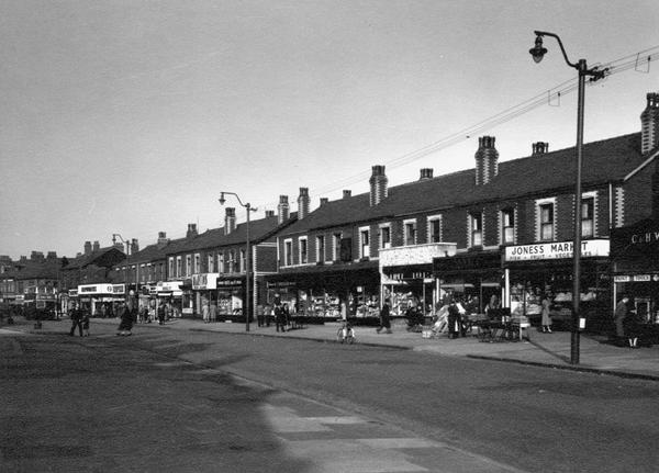 We now start a long trek north along Palatine Road where. located in the parade of shops shown right in 1959, we will encounter the next three bars. First up, at 387 Palatine Road, we will be pressing our noses against the windows of Tate's Bar (formerly Anton's and before that Bar Bibo). Having been converted from shop premises, it was opened around 2005 and is decorated in a modern spartan style. Unfortunately it is a keg-only bar having never been known to have served real ale over its whole year life.
Continuing north, our second encounter is with Escape 2 located at 377 Palatine Road. Opened around 2005 it was, like Bar Bibo, converted from former shop premises. Having been re-named from Escape after its 2013 refurbishment it is again devoid of real ale. Oh dear! Onwards we go.
Continuing travelling north we reach our third outlet, Grapes Lounge Bar, located at 297 Palatine Road. Opened in 2015 as the Grape Escape Lounge Bar having been converted from a former Chinese take-away. Previously two or three cask ales were on offer in the long, mood-lit bar area, complemented by an outside drinking area on the street frontage. Will the weather be clement enough to allow alfresco drinking this evening? Well, "No", as the establishment is currently closed, so onward.

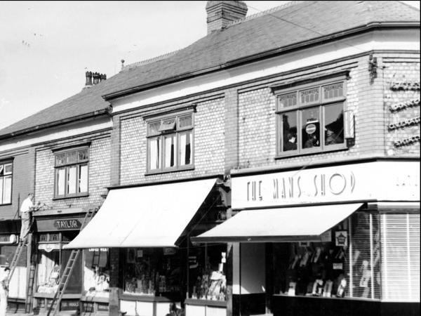 To reach our penultimate pub we need to proceed to Church Road, there to discover Northenden Untapped. This is a new bar opened November 2019 (photo left) in former shop premises (photo right) in an under-pubbed area of the town. The inspiration to open the bar was due to the changing local demographics, with many young professionals moving into the area, but finding little in the way of cask or craft beers to drink. To alleviate this a three handpump "wicket" was complemented by keg/craft beer taps behind, and a selection of canned craft beers. Unfortunately economic pressure has seen the handpumps falling in to disuse.
NB. the bar does NOT accept cash, all payments by CARD please.
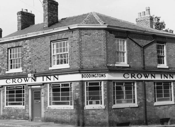
 Our ultimate port of call requires a short towards the church. and the Crown Inn (bet you thought it would be called the Church! We pass that closed establishment on route.) located at 19 Ford Lane. This is probably the oldest (and smallest) pub in Northenden and is/was often called the Corner Pin. A former Boddingtons house, now owned by Punch Taverns, that had not sold any cask ale for some years. That is until 2016 when an entrepreneurial couple took on the lease. Back came cask ale, and the place was given a smart and very thorough make-over. Two small yet traditionally decorated rooms flank the central bar and a small outside drinking area beyond this completes the accommodation. Unless the weather is very summery I doubt we will be sampling the delights of the latter tonight.
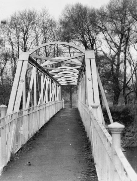
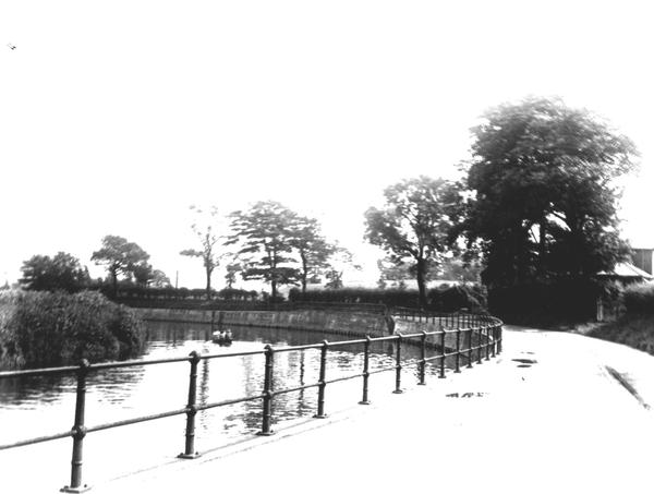 While savouring your pint, contemplate the name of the road outside, Ford Lane. Northenden was on a major (and very old) "Salt Road" from Cheshire towards Manchester and thence into the West Riding of Yorkshire. Unfortunately there was no bridge over the Mersey between Sale and Stockport, until Bonnie Prince Charlie's army built a temporary bridge over the Mersey in 1745 (approximatly where Manchester Road now crosses into Didsbury). The ford at Northenden was unusual because its northern and southern ends were not opposite each other, so people using the ford had to wade about 500 feet along the riverbed. In 1901 pedestrians got a better deal when the Simon's Bridge (links to a photo of the bridge and dedication plate) was built at the northern end of the ford. Unfortunately users of the ford got a worse deal in the 1980s when the flood prevention work carried out all along the Mersey deepened the river making fording the river a thing of the past.

Below, clicking on Map will call up a Google travel map with that location automatically set as the destination. Insert your current location (post code?) as the start and choose a travel mode (public, car, cycle or foot) and discover your travel options.
Following THIS LINK will take you to the Transport for Greater Manchester website for current travel information.
Northenden |
||||
| Timing | Pub Name | Address | Travel | Notes |
| 7.30pm Start point: | Farmers Arms | 26 Longley Lane M22 4JR |
Map | |
| Then | Wythenshaw Cricket Club | 78 Longley Lane M22 4JF |
Map | |
| 8.30pm Mid point: | Lounge About | 424 Palatine Road M22 4JT |
Map | |
| Followed by | Tate's Bar | 387 Palatine Road M22 4FY |
Map | No Real Ale |
| Escape 2 | 377 Palatine Road M22 4FY |
Map | No Real Ale | |
| Grapes Lounge Bar | 297 Palatine Road M22 4HH |
Map | Closed | |
| Northenden Untapped | 67 Church Road M22 4WD |
Map | No Real Ale | |
| Finishing at: | Crown Inn | 19 Ford Lane M22 4WE |
Map | |
View Northenden Walkabout in a separate window.
Images on this page are thumbnails from various sources and no right is claimed. If you own copyright and wish either removal or acknowledgement please advise me and I'll promptly follow your wishes.